...and very nicely implemented by you.

Work in Progress
Antietam 17th September 1862
That's a exellent idea for a conversion Chris.
...and very nicely implemented by you.
...and very nicely implemented by you.
-
Santi Pérez likes this post. •
- Reply
-

Egbert
- Posts: 597
- Member since:
16 Oct 2008, 06:47
Progress
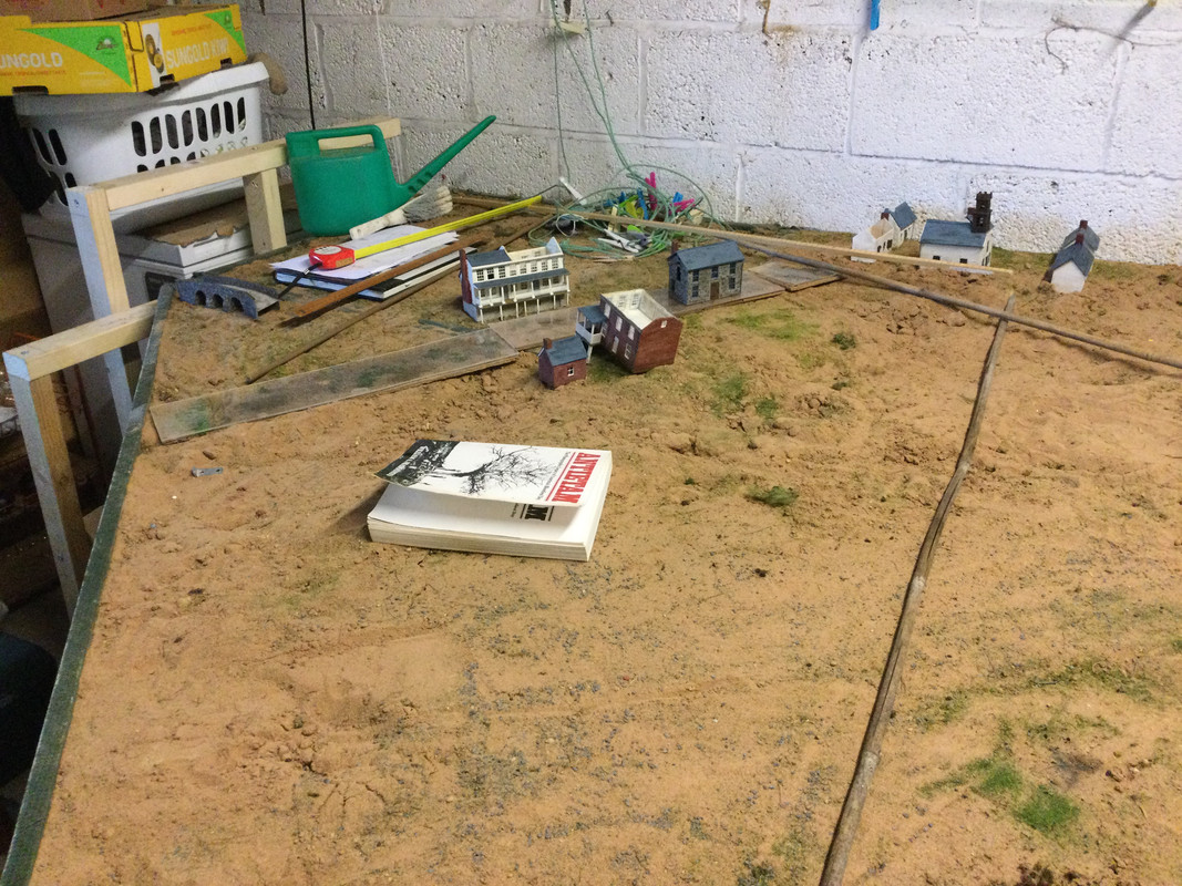
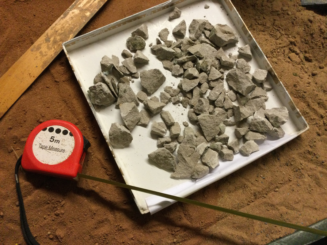
I have been measuring distances in order to start the laying out of the battlefield.
A complete nightmare with different sources using different scales which is understandable but the same source using different scales within its terms of reference?
Bonkers.
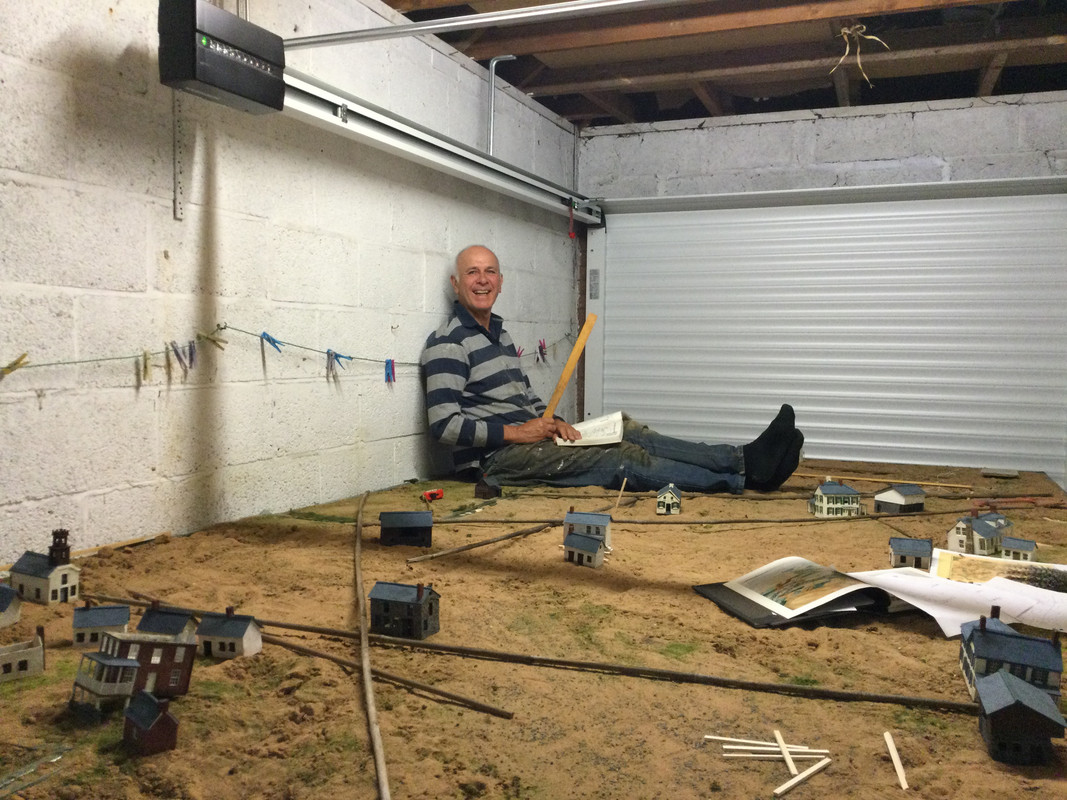
What a lovely garage door.
To save my already adled brain I have relied heavily on Mr Frassanito’s wonderful book as he actually worked out where Gardner took his pictures, what angles, distances etc.
The LOC maps are great for the detailed work.
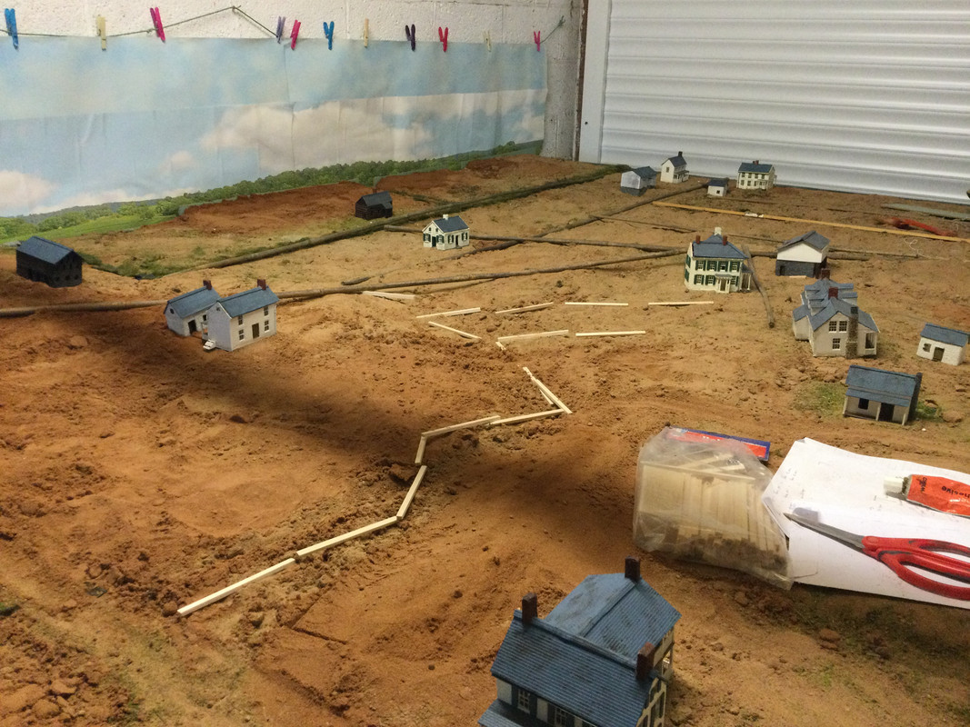
I have used my bean stick method of laying out the principle roads .
The water courses are my usual method and apart from the creek are mercifully few.
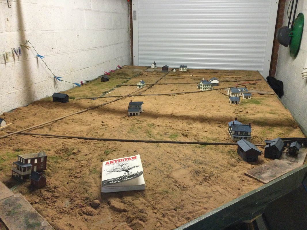
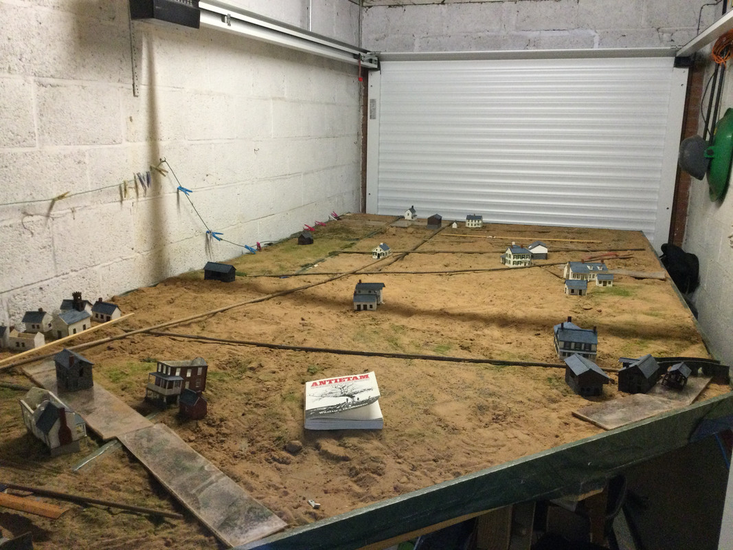
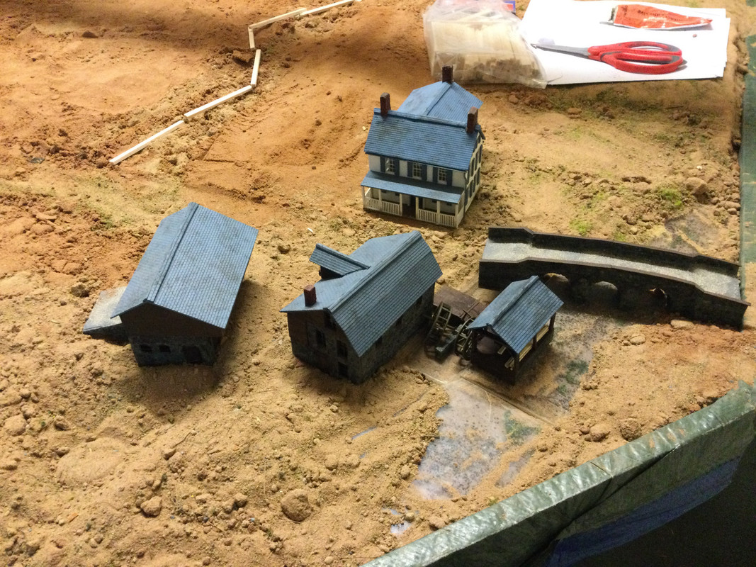
The northern end of the field showing showing Mr Millers farm, the Mumma farm and the roof of the roulette farm.
The southern end showing Sharpsburg, the Sherrick and Otto farms.
The Rhorbach bridge will be on a separate section, the frame of which is in the picture.
Lots of manoeuvring to be done, sand pies to be built but it’s a start.
Best wishes,
Chris
I have been measuring distances in order to start the laying out of the battlefield.
A complete nightmare with different sources using different scales which is understandable but the same source using different scales within its terms of reference?
Bonkers.
What a lovely garage door.
To save my already adled brain I have relied heavily on Mr Frassanito’s wonderful book as he actually worked out where Gardner took his pictures, what angles, distances etc.
The LOC maps are great for the detailed work.
I have used my bean stick method of laying out the principle roads .
The water courses are my usual method and apart from the creek are mercifully few.
The northern end of the field showing showing Mr Millers farm, the Mumma farm and the roof of the roulette farm.
The southern end showing Sharpsburg, the Sherrick and Otto farms.
The Rhorbach bridge will be on a separate section, the frame of which is in the picture.
Lots of manoeuvring to be done, sand pies to be built but it’s a start.
Best wishes,
Chris
-
C M Dodson

- Posts: 2572
- Member since:
01 May 2015, 18:48
Your photo looks amazing. A Man and his Hobby! I am looking forward to see the next History-Blockbuster.
-

MABO
") Supporting Member (Gold)
Supporting Member (Gold) - Posts: 9146
- Member since:
12 May 2008, 18:01
-
Captain Sibourne
- Posts: 332
- Member since:
02 Feb 2014, 09:12
Agree with Jan and the captain! Great to see! And nice to see a face behind the hobby too.
-

Susofrick
- Supporting Member (Gold)
- Posts: 7681
- Member since:
19 Feb 2008, 12:10
Hey Chris,
it looks like you're playing in a big sandpit!
Nice to see your new garage door.
I am happy that your great work continues!
It will be beautiful again!
it looks like you're playing in a big sandpit!
Nice to see your new garage door.
I am happy that your great work continues!
It will be beautiful again!
-
Santi Pérez likes this post. •
- Reply
-
Egbert
- Posts: 597
- Member since:
16 Oct 2008, 06:47
Help keep the forum online!
or become a supporting member
-

Konrad
- Supporting Member (Gold)

- Posts: 2632
- Member since:
19 Oct 2007, 12:59
It's clear that the complete battlefield will be bigger than almost any car which can occupy that garage, Chris. 
My very best congratulations and all my encouragement for this titanic project that exceeds the expectations of any diorama maker (at least mine).

Santi.
My very best congratulations and all my encouragement for this titanic project that exceeds the expectations of any diorama maker (at least mine).
Santi.
-

Santi Pérez
- Posts: 1869
- Member since:
28 Aug 2016, 19:42
Best picture of the day! Such a nice garagedoor, pity there is someone in front of it! 

What I also like is that you can make your terrain ready for the battle now! Not much to see now but already impressive!
What I also like is that you can make your terrain ready for the battle now! Not much to see now but already impressive!
-

Peter
 Moderator
- Posts: 22510
- Member since:
25 Mar 2008, 18:51
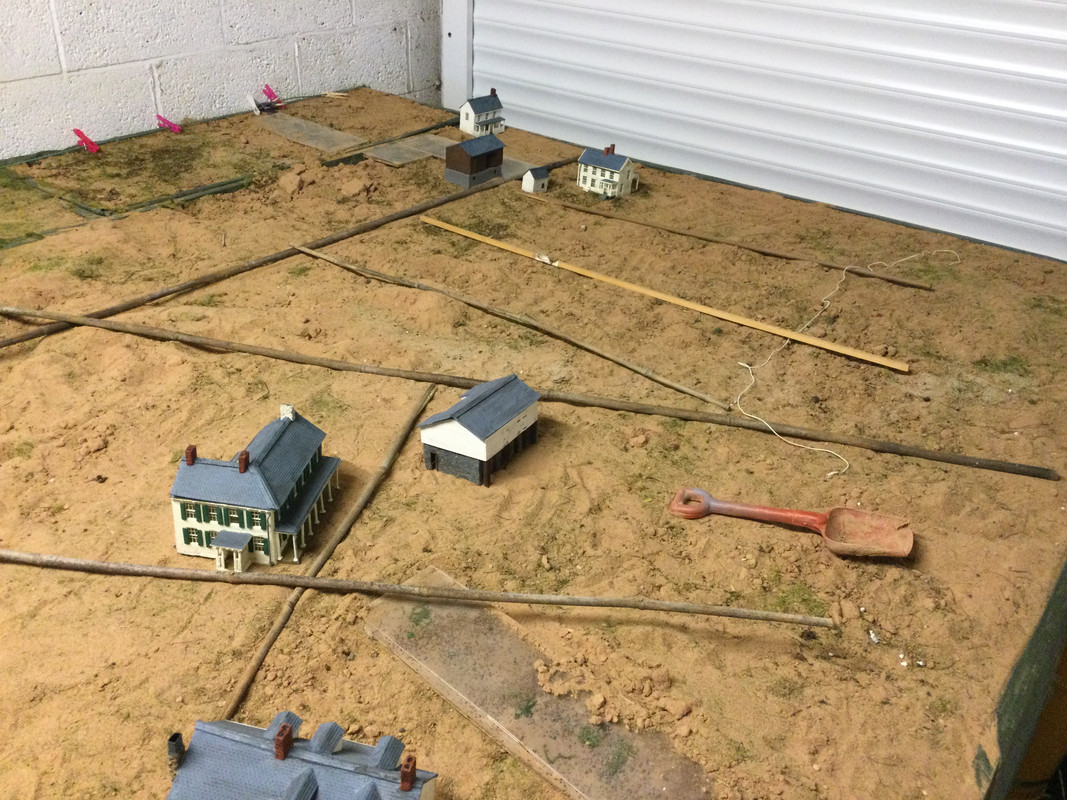
Battlefield preparation
I have now erected the background sheets for the view to the west.
Whilst not completely accurate they are reflective and when the woods are inserted they will have the ‘feel’ of the rolling countryside of this region.
The weather in 1862 was,after a damp night and misty sunrise, sunny so I am happy with this.
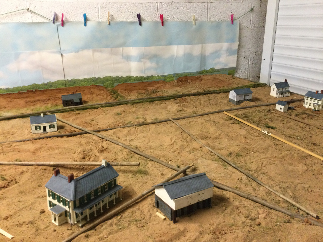
I have also preliminary sculpted the main watercourses including the mill race at the middle bridge.
The Nicodemus hill and Hauser ridge are in place along with the principle elevations.
The ground rises gently from the middle bridge to the ridge line and thence down into Sharpsburg. I took a drive with Google Earth along this road with views to the side enroute, very interesting.
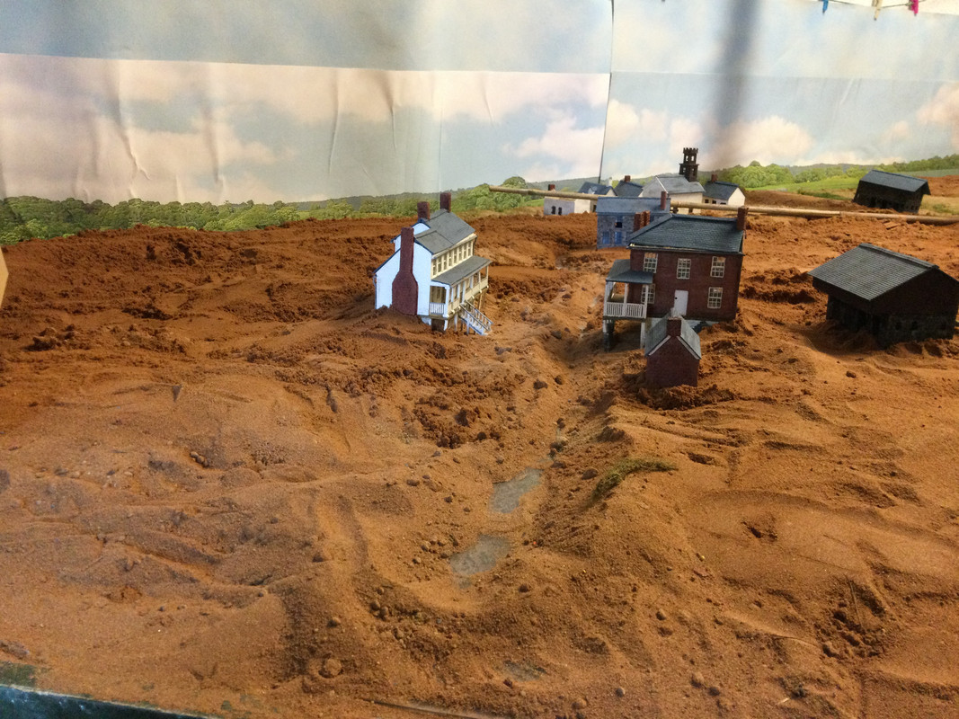
The Otto and Sherrick farms are in their approximate positions leading to the mill and town beyond.
The under lying geology of the area is limestone which shows itself on the surface in places.
I found some limestone in the garden and smashed it up ( inside polythene to avoid injury). The LOC. maps are excellent as to the positioning of these rocks, which certainly in the West wood were good cover for the Confederates.
The roads have been roughly positioned using balsa for the sunken lane area.
This is the view north from the Newcomer house towards the North wood and Miller farm.
The ground rises up from the creek before dropping down to the lane itself. This was a primary factor for the bloodbath there in the original battle.
I have a hankering to build the Roulette barn as there is space but we shall see.
It must be noted that whilst the properties far exceed their scale ground space I am trying to replicate the look and the ‘feel’ of the battlefield.
The rules will discount their presence for fire and movement purposes and photographic perspective should provide a realism regarding distances.
Progress.
Best wishes,
Chris
I have now erected the background sheets for the view to the west.
Whilst not completely accurate they are reflective and when the woods are inserted they will have the ‘feel’ of the rolling countryside of this region.
The weather in 1862 was,after a damp night and misty sunrise, sunny so I am happy with this.
I have also preliminary sculpted the main watercourses including the mill race at the middle bridge.
The Nicodemus hill and Hauser ridge are in place along with the principle elevations.
The ground rises gently from the middle bridge to the ridge line and thence down into Sharpsburg. I took a drive with Google Earth along this road with views to the side enroute, very interesting.
The Otto and Sherrick farms are in their approximate positions leading to the mill and town beyond.
The under lying geology of the area is limestone which shows itself on the surface in places.
I found some limestone in the garden and smashed it up ( inside polythene to avoid injury). The LOC. maps are excellent as to the positioning of these rocks, which certainly in the West wood were good cover for the Confederates.
The roads have been roughly positioned using balsa for the sunken lane area.
This is the view north from the Newcomer house towards the North wood and Miller farm.
The ground rises up from the creek before dropping down to the lane itself. This was a primary factor for the bloodbath there in the original battle.
I have a hankering to build the Roulette barn as there is space but we shall see.
It must be noted that whilst the properties far exceed their scale ground space I am trying to replicate the look and the ‘feel’ of the battlefield.
The rules will discount their presence for fire and movement purposes and photographic perspective should provide a realism regarding distances.
Progress.
Best wishes,
Chris
-
C M Dodson
- Posts: 2572
- Member since:
01 May 2015, 18:48
Very interesting to see how a 'work in progress' on this large scale is put together. It is all most impressive.
I like the buildings very much. Will look forward to more pictures as the landscape of the battlefield emerges from the sand!
I like the buildings very much. Will look forward to more pictures as the landscape of the battlefield emerges from the sand!
-

Minuteman
- Posts: 1141
- Member since:
06 Mar 2020, 21:38
Wonderful stuff, Chris, as always. I'm getting very excited to see all your separate pieces coming together.
Best,
John
Best,
John
-
John Simmons

- Posts: 59
- Member since:
17 Apr 2020, 14:12
Mr Millers Cornfield
I have been constructing the Miller cornfield, one of the many present on the battlefield.

As previously described the farmers employed a chequer board pattern of sowing.
I tried this but the result is problematic from a visual aspect as the ‘corridors’ for harvesting make the field look very thin.
I decided to place three stalks at each intersection creating the impression of greater density.
This seems to work well but I will scatter my Nigella to replicate the nearly ripe nature of the stalks.
I am very pleased with my snake fencing although some weathering might be appropriate on the diagonals.
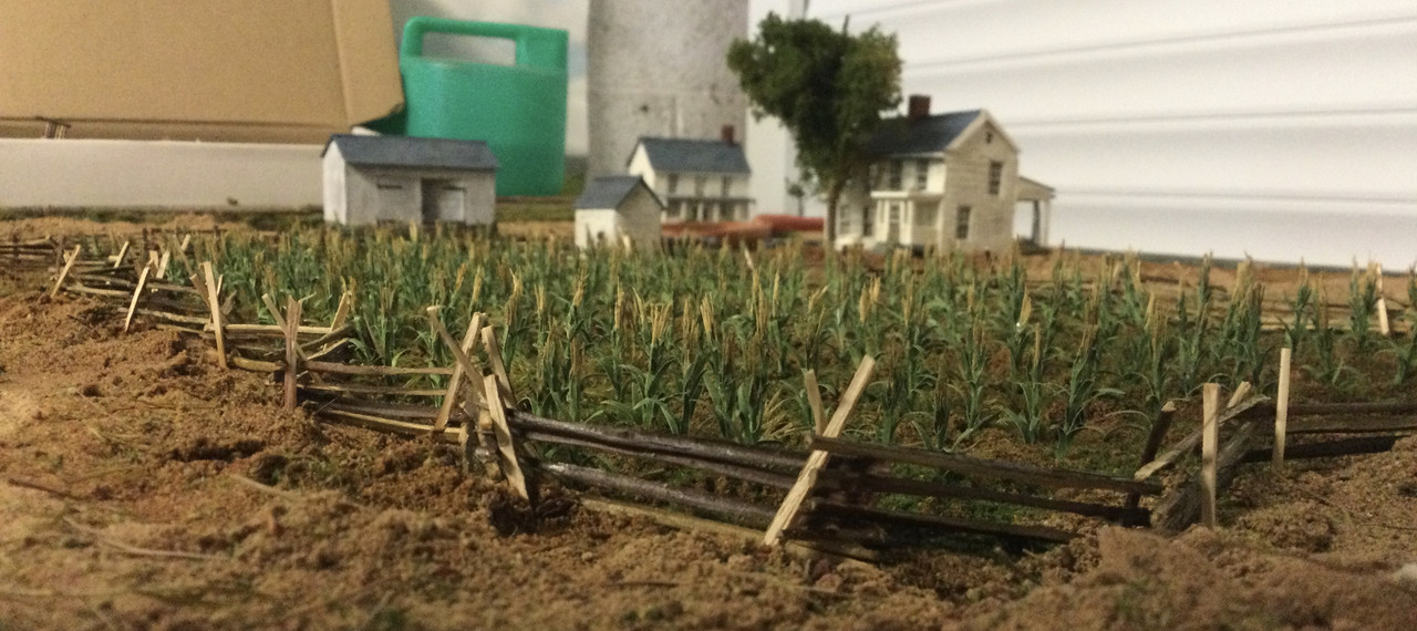
Lots to do.
Best wishes,
Chris
I have been constructing the Miller cornfield, one of the many present on the battlefield.
As previously described the farmers employed a chequer board pattern of sowing.
I tried this but the result is problematic from a visual aspect as the ‘corridors’ for harvesting make the field look very thin.
I decided to place three stalks at each intersection creating the impression of greater density.
This seems to work well but I will scatter my Nigella to replicate the nearly ripe nature of the stalks.
I am very pleased with my snake fencing although some weathering might be appropriate on the diagonals.
Lots to do.
Best wishes,
Chris
-
C M Dodson
- Posts: 2572
- Member since:
01 May 2015, 18:48
Help keep the forum online!
or become a supporting member
Wow. This is the best-looking cornfield in our scale that I've seen. You must be a very patient man to plant all those individual stalks. As you say, there were lots of other cornfields at Sharpsburg, but this was "the" cornfield. Looking forward to seeing the fighting there.
Best, John
Best, John
-
Santi Pérez likes this post. •
- Reply
-
John Simmons
- Posts: 59
- Member since:
17 Apr 2020, 14:12
Peter wrote:I could have missed it, but did you tell what you used for the corn?
Yes! I would like to know as well!
-
MABO
- Supporting Member (Gold)
- Posts: 9146
- Member since:
12 May 2008, 18:01
Dear Chris,
I only can agree with the others and express my deepest respect to you.
The fields look incredibly fantastic and very natural.
I only can agree with the others and express my deepest respect to you.
The fields look incredibly fantastic and very natural.
-
Santi Pérez likes this post. •
- Reply
-
Egbert
- Posts: 597
- Member since:
16 Oct 2008, 06:47
Hi Chris,
You are probability the hobby equivalent of the combination of Michel Angelo and Leonardo da Vinci.
Thank you.
CPN
You are probability the hobby equivalent of the combination of Michel Angelo and Leonardo da Vinci.
Thank you.
CPN
-
Santi Pérez likes this post. •
- Reply
-
CPN

- Posts: 207
- Member since:
11 Nov 2014, 17:15